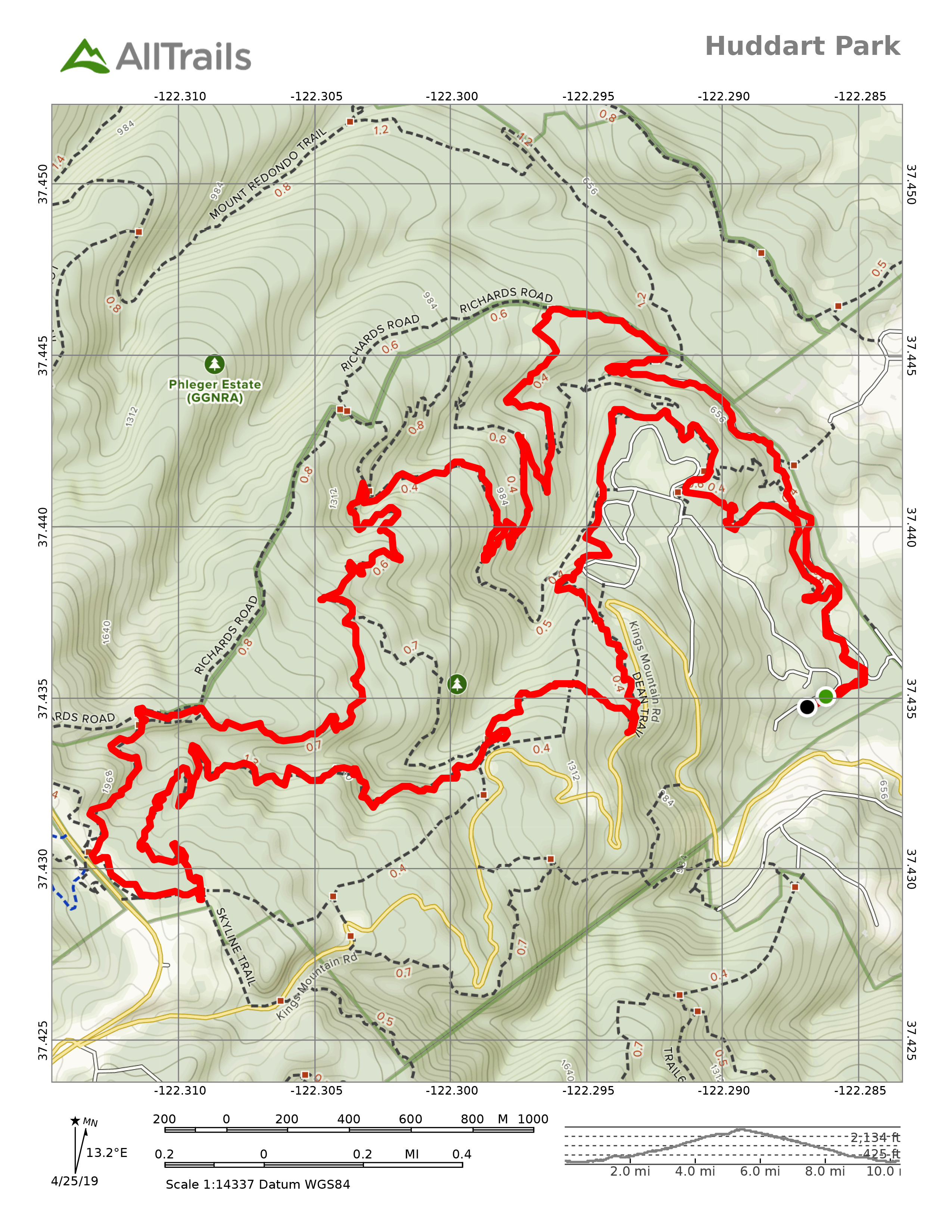
After a few attempts, I finally made it all the way from the base of Huddart Park to Skyline and back down. 10.3 miles, 1,716ft elevation gain, 3:35:15 moving time, 80°F outside temperature, no wind. It wasn’t tough until I hit mile 8 or 9.
The ultimate challenge remains to get to the top using only the Richard’s Road Trail, a raw 2.75 mile, 1,500 foot climb straight up the mountain which historically was used to drag lumber down to Redwood City.
I don’t recommend visiting Huddart Park right now unless you like lots of bugs and walking through spider webs.